|
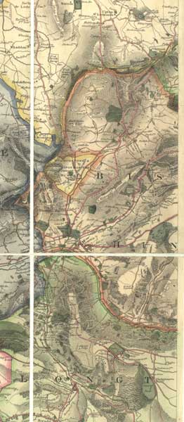
Tolls for using turnpike roads were collected at turnpike gates or toll bars. Bryant's map of 1824 shows where they were. The symbol 'TB' stands for 'Toll Bar'. The name 'turnpike' comes from the spikes on the top of the gate which were meant to deter horsemen from jumping over and not paying. Once the toll was paid the pikes were turned aside as the gate opened. |
 |
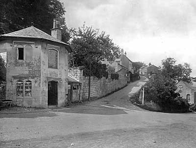 |
Although the gate has gone, the gatekeeper's house at Butterrow is still there and even has the board above the door listing the charges. Like many such houses, it was built in that particular shape so that the gatekeeper could see who was coming along the road through the windows, set at an angle on either side of the door. |
|
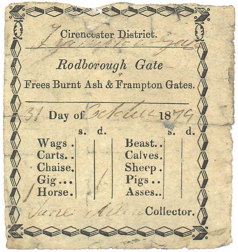
This turnpike ticket was issued on 31 October 1879 at Rodborough Gate. The horse-rider was charged 6d [21/2p] by Jane Allen, the gatekeeper. Producing the ticket later that day would have allowed free passage at two other gates on the same road. Tolls were also charged on carts, carriages and animals being driven to market. At each toll bar there was a small side-gate used by people on foot who were not charged. |
 |
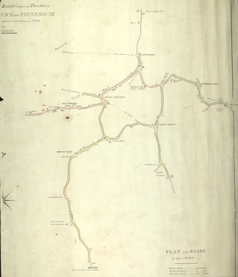 |
Turnpikes only covered the main roads. Until the late 19th century, minor roads still had to be maintained at the expense of each parish. This parish surveyor's map shows the lanes round Westrip and Cashes Green coloured coded to show which parish was responsible - Stroud (blue/green), Randwick (pink) and Stonehouse (yellow). By 1900, responsibility for main roads had passed to Gloucestershire County Council and for minor roads to Stroud Urban and Rural District Councils. From January 2016, this website is managed by Stroud Local |